Object detection in satellite imagery using CNN and SAM algorithms
May 2, 2025
·
1 min read
This Google Colab notebook demonstrates an automated approach for detecting individual trees in satellite imagery. It leverages the power of a Convolutional Neural Network (CNN) for feature extraction, enhanced by the precise segmentation capabilities of the Segment Anything Model (SAM). By integrating these advanced deep learning techniques with the geospatial processing capabilities of the leafmap library, this project enables users to accurately identify and locate trees within user-defined regions of interest.
Core Technical Skills:
- Convolutional Neural Networks (CNNs): Mentioning experience or application of CNNs for feature extraction or object detection.
- Segment Anything Model (SAM): Highlighting the use and understanding of sophisticated segmentation algorithms like SAM.
- Satellite Imagery Analysis: Indicating proficiency in working with and analyzing data from satellite sources.
- Geospatial Data Processing: Demonstrating skills in handling and manipulating geospatial data.
- Python Programming: Essential for implementing the project.
- Deep Learning: A broader understanding of deep learning concepts and techniques.
- Image Segmentation: Specifically mentioning skills in segmenting objects within images.
- Object Detection: The overarching goal of the project.
- leafmap Library: Experience with using the leafmap library for geospatial tasks.
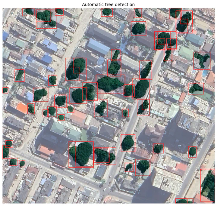
Results:
The figure suggests that the automatic tree detection algorithm has successfully identified a significant number of individual trees within the scene. The red bounding boxes appear to closely encapsulate the visible tree canopies.