Mapping the Invisible: Flood Impact Analysis over Lomé (May 2024)
In the early hours of May 26th, 2024, residents across Lomé awoke to a city transformed. Streets once bustling with life had turned into rushing canals. Markets stood silent, their stalls submerged. For thousands, homes became islands—or worse, were swept away entirely. The city had been overwhelmed by relentless rainfall, causing widespread flooding and plunging vulnerable communities into chaos.
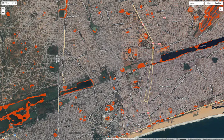
This personal investigation leverages Synthetic Aperture Radar (SAR) imagery from the Sentinel-1 satellite to map and assess the extent of this disaster. By comparing pre- and post-flood scenes, and integrating slope data from Digital Elevation Models (DEMs), this study provides a clear, data-driven view of how water reshaped the urban landscape of Lomé. Beyond capturing a moment of crisis, the project demonstrates how satellite data can inform risk assessment, guide urban planning, and ultimately support more resilient futures—especially for cities like Lomé, where the stakes grow higher with every season.